Current flood situation in Atyrau region
The rivers of the region coming from the Aktobe region experienced peak floods.
According to the forecast, the arrival of a flood wave from the territory of the West Kazakhstan region is expected in the third ten days of April on April 28-29, 2024, while the water level will exceed the dangerous mark of 550 cm, which will lead to the release of water from the floodplain and flooding of settlements located along the Zhaiyk River in the Makhambet region ( Makhambet, Taldykol) and the administrative territories of the city of Atyrau (Almaly, Bereke, Erkinkala, Damba).
For reference: in 1994, when the water level reached 600 cm, the settlements of Makhambet, Almaly, Sokolov, and Bereke were flooded.
Current flood situation in the East Kazakhstan region.
Currently, the region is experiencing the first wave of floods associated with snowmelt on the flat territory, the formation of slope runoff and the opening of rivers in the region, which will last until mid-April.
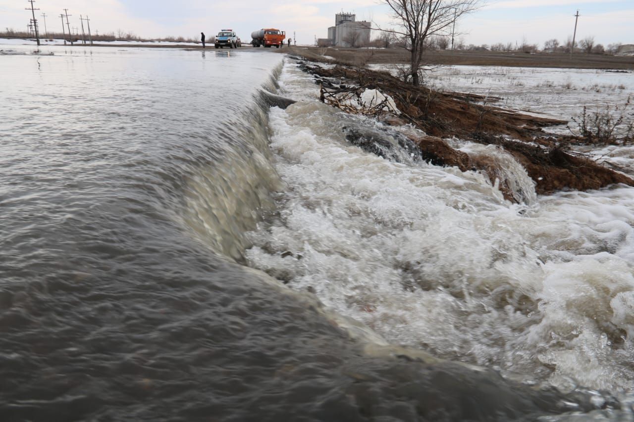
Current flood situation in the West Kazakhstan region.
On most of the region's internal rivers, the peak floods have passed.
The peak of the flood on the Zhaiyk River due to the flow of water from the Russian Federation (Orenburg) to the city of Uralsk is expected on April 18-20, 2024.
The expected time of arrival of water in the city of Uralsk is 04/16-20/2024. The predicted water levels can reach 990 cm – 04/19/2024, 1038 cm – 04/20/2024.
Critical mark at the hydrological station of the river. Ural - Uralsk is 850 cm, above which there is a reverse outflow to the Shagan River, which will lead to flooding of dacha areas in the city of Uralsk. Also at risk are settlements located along the Zhaiyk River in the Burlinsky, Baiterek, Terektinsky, and Akzhaik regions.
Current flood situation in Kostanay region
On most rivers in the region, the peak of the flood has passed and declines in water levels are observed.
Current flood situation in the North Kazakhstan region.
Most of the region's internal rivers have experienced peak floods (the first wave).
The second wave of floods began on the Yesil River due to the flow of water from the tributaries of the Yesil River (Terisakkan, Zhabai and Kalkutan rivers) located in the Akmola region.
Expected dates for the passage of the peaks of the second flood wave on the Yesil River at gauging stations:
- SE r. Yesil-v. Toksan bi 04/15-20/2024
- GP Esil river - Pokrovka village 04/18-23/2024
- GP r.Esil-v.Novonikolsk 04/20-25/2024
- SE R.Esil-Petropavlovsk 04/22-27/2024
Current flood situation in Akmola region
In most parts of the Akmola region, water levels continue to fluctuate; in some places, dangerous levels continue to be exceeded, melt runoff continues to reach, water overflows into floodplain areas, flooding of populated areas and roads from river floods and melt water.
On the Zhabai, Kalkutan rivers and side tributaries: the Zhylandy river (tributary of the Zhabai river), Boxuk river, Arshaly river (tributaries of the Kalkutan river) the flood is subsiding.
On the Yesil River (border with North Kazakhstan region) in the area of the State Enterprise Derzhavinsk and Kamenny Quarry (Akmola region) there is a second wave of flood associated with the runoff reaching the side tributaries of the Zhabai River, the. Zhylandy, Arshaly river, Boxuk river, Kalkutan river. Further increases in water levels are expected.