The expected volume of spring flood runoff in the lowland rivers of Kazakhstan is based on hydrometeorological observations and measurements as of March 01, 2024.
According to the remote sensing images of NASA satellites processed by Kazhydromet RSE, as of March 01, 2024, the area of the territory of Kazakhstan covered with snow is 72%.
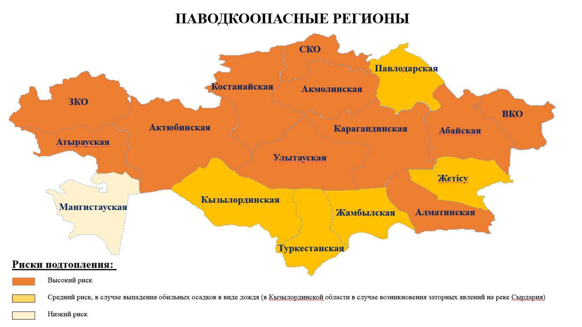
Analyzing the amount of precipitation, water reserves in the snow, indicators of autumn soil moisture, the depth of soil freezing, as well as ice regimes of rivers, a preliminary assessment of flood-hazardous regions is given.
Regions with increased risks: Abai, Akmola, Aktobe, Almaty, East Kazakhstan, West Kazakhstan, Karaganda, Kostanay, North Kazakhstan regions and Zhetisu region.
With medium risks: Atyrau, Zhambyl, Kyzylorda, Pavlodar, Turkestan regions and Ulytau region.
With low risks: Mangystau region.
The volume of moisture reserves by long-term average values:
- in the Karaganda region it is lower by 30-49%;
- in the Ulytau region, it is lower by 13 and 20%;
- in the Akmola region, the basins of the Kalkutan, Zhabai and Shagalaly rivers are 21-43% higher than the long-term average values, and in the basins of the Selety (inflow to the Seletinsky reservoir), Yesil and Moyildy rivers (inflow to the Astana reservoir) are 26-40% lower%;
- in the North Kazakhstan region, it is 57% higher%;
- in Kostanay region, the basins of the Tobol, Ayat rivers (tributaries to the Verkhne-Tobolsk and Karatomar reservoirs) and Toguzak are 30-98% higher, and in the basins of the Torgai and Karatorgai rivers are 20-23% lower.
- in the Aktobe region, the basins of the Uil and Kosistek rivers are 26 and 52% higher, in the Or River basin within the long-term average values, in the basins of the Kargaly rivers (inflow to the Kargaly reservoir), Ilek (inflow to the Aktobe reservoir), Irgiz and Temir are 16-68 lower%;
- in the West Kazakhstan region it is lower by 17-43%;
- in Atyrau region, the Emba River basin is 62% lower.
Currently, the snow accumulation process continues.
The depth of soil freezing is mainly lower than last year's indicators, on average from 1 to 91 cm in Akmola, Aktobe, Atyrau, West Kazakhstan, Karaganda, Kostanay, North Kazakhstan and Ulytau regions. With the exception of certain river basins in Akmola (Kalkutan, Yesil) and Karaganda (Tokyrau) regions, where the depth of soil freezing is higher than last year's figures from 11 to 33 cm.
Also, in the basins of the Nura and Sherubainura rivers of Karaganda region, Kengir and Sarysu of Ulytau region, Yesil, Silety (tributary to the Siletinsky reservoir), Shagalaly and Zhabai of Akmola region, Yesil of North Kazakhstan region, Tobol, Ayat and Torgai of Kostanay region, Ilek, Uil and Irgiz of Aktobe region, Chizha-2, Utva, Derkul, Shagan, Olenty and Shiderty of West Kazakhstan region, Emba of Atyrau region, ice crusts on the soil surface with a thickness of up to 6.6 cm are observed.
In the case of a sharp increase in the temperature background and heavy rains in March, this can lead to the occurrence of talo-rain floods.