Kazhydromet has opened access to an interactive map of hydrological monitoring
Published 22.08.2024
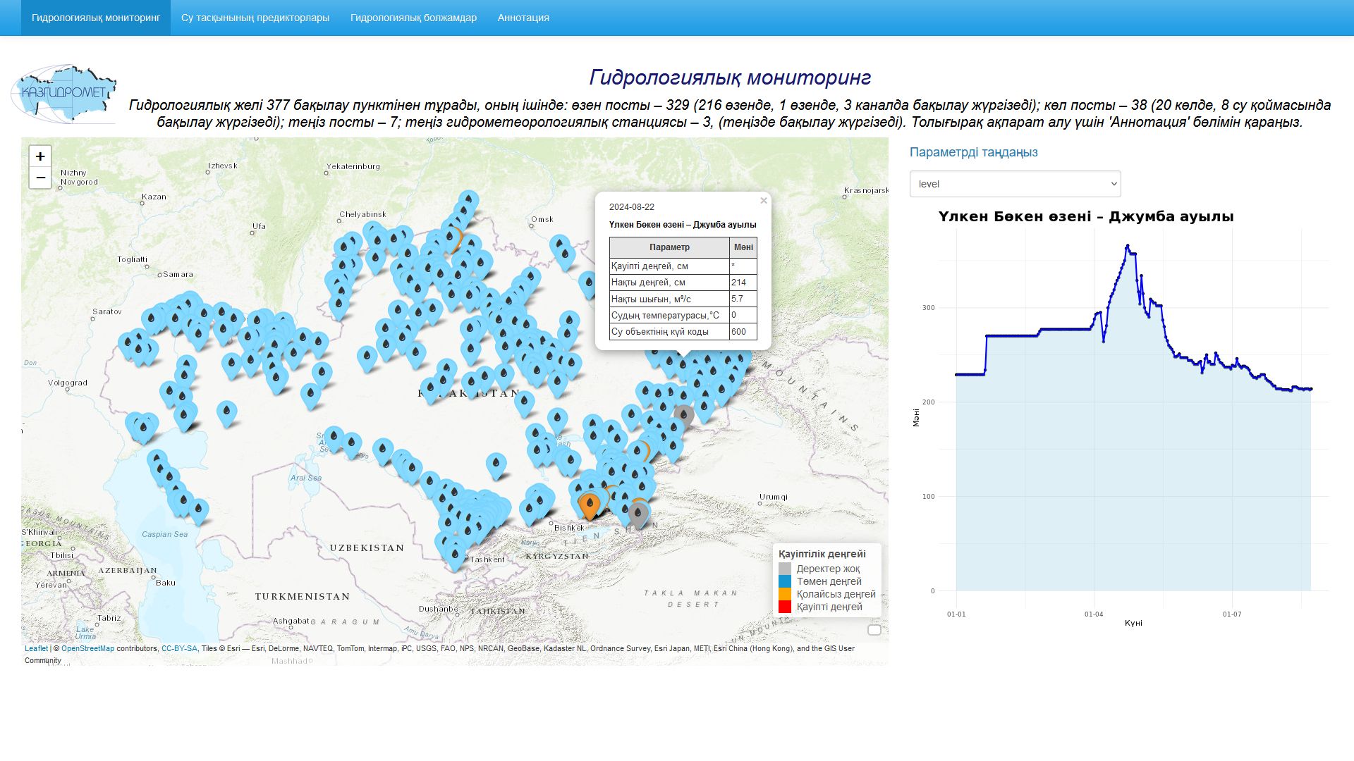
The interactive map "Hydrological Monitoring" provides detailed information about the current state of water bodies in Kazakhstan. The data in the section comes from the hydrological network of RSE "Kazhydromet", which includes 377 observation points, including: 329 river, 38 lake and 10 sea posts and stations.
When you click on any hydrological post, a table with information appears on the map:
* The name of the hydrological post.
* Dangerous water level in centimeters.
* The actual water level in centimeters.
* Water temperature.
* Actual water consumption in cubic meters per second (m3/s).
The data table is updated daily at 12 o'clock local time.
In addition to monitoring information, the map includes modules:
- "Flood predictors", which is an important tool for assessing and predicting flood risk. The module consists of three sections, each of which provides the necessary figures for flood analysis and forecasting, as well as the values of these parameters for the past year and their regulatory data.
- "Hydrological forecasts", where the projected flood volumes for lowland rivers and the expected average water consumption for the growing season for mountain rivers and their norms are displayed on the map.
For the convenience of users, an interactive map http://ecodata.kz:3838/app_dg_map_ru / will be supplemented and changed.
*Recommendations for using the interactive map are available at the link: